What Is a Bomb Cyclone? Updates on Pacific Northwest Weather Forecast

Here’s everything you need to know about the deadly winter storm bringing high winds, heavy rain, and snow to the Pacific Northwest and Canada’s British Columbia region.
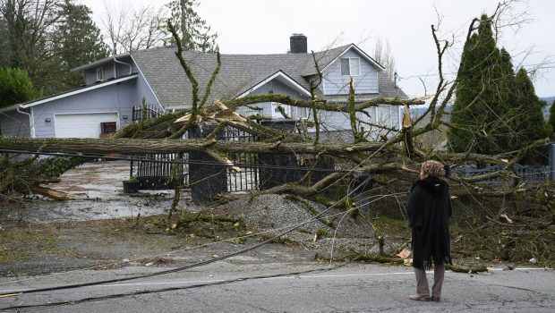
The Pacific Northwest has been severely impacted by a powerful cyclone, unleashing wind gusts of 60 to nearly 80 mph across western Washington, with even stronger winds reaching up to 101 mph just off the coast, according to the National Weather Service in Seattle.
As of Wednesday, more than 700,000 homes and businesses in the state have lost power. Tragically, two fatalities have also been reported near Seattle. A woman in her 50s was killed when a tree fell at a homeless encampment in Lynnwood around 7 p.m. PT on Tuesday, according to South County Fire. In a separate incident, a resident of Bellevue’s Bridle Trails neighborhood contacted emergency services to report that a tree had crashed into his home, killing his wife, firefighters confirmed.
Read on to learn more about the bomb cyclone, how it forms, and what the region can expect next.
What Is a Bomb Cyclone?
A bomb cyclone is a term used to describe a type of intense storm that undergoes “bombogenesis,” which refers to a rapid drop in atmospheric pressure, typically by 24 millibars or more within 24 hours. This process leads to a powerful, fast-developing low-pressure system, often resulting in heavy rain, snow, and high winds. Bomb cyclones are most commonly seen in the winter months and can cause significant disruption due to their severity, particularly along coastlines or in areas prone to winter storms.
As the #BombCyclone churns off the Pacific Northwest coast, the atmospheric river to the south unfurls into a firehose, dousing Northern California and Oregon with non-stop precipitation. pic.twitter.com/NBq8g7h1tS
— Zoom Earth (@zoom_earth) November 20, 2024
The Pacific Northwest usually experiences an increase in storm activity during late fall and winter. As the jet stream shifts southward, it brings a series of low-pressure systems, which could include bomb cyclones. The region is also vulnerable to atmospheric rivers, which are narrow corridors of concentrated moisture in the atmosphere. When these align with a bomb cyclone, they can produce heavy rain and significant flooding risks, especially in western Washington and Oregon.
What’s the Next Weather Forecast for the Region?
The atmospheric river currently impacting California is expected to bring “extreme rainfall totals” and will persist through the end of the week, according to the weather service. The northern California coast and inland mountain ranges could see 10 to 15 inches of rain, significantly raising the risk of life-threatening flash floods, rockslides, and debris flows, the agency warned.
Another "bomb cyclone" will come uncomfortably close to the Washington coast on Friday.
Then, the first one will come back around for another pass.
These storms will pirouette for the next 4-5 days. pic.twitter.com/btPHb0wjlh
— Ryan Maue (@RyanMaue) November 21, 2024
Compounding the situation, a separate storm is forecast to form and rapidly intensify off the Northwest coast on Friday, further strengthening the atmospheric river effect.
“Life-threatening flooding across coastal Northwest California is expected due to the very strong and long duration atmospheric river,” the Weather Prediction Center warned. “Dangerous flooding, rock slides, and debris flows are likely.”