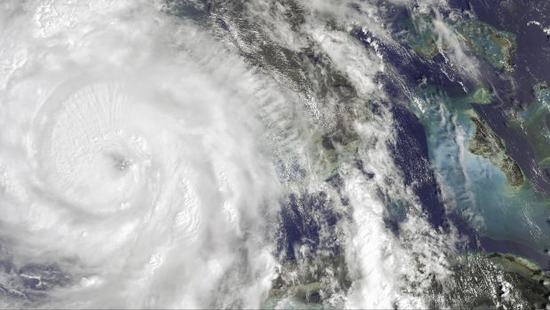
Hurricane Categories: Understanding the Differences as Milton Downgrades

As of Wednesday morning, Milton is at Category 4 status, having spent much of Tuesday at Category 5. However, it is still considered a major and extremely dangerous storm.
A Wednesday morning forecast from the National Hurricane Center indicates that Hurricane Milton is approaching landfall Wednesday night as a Category 4, with winds near 130 mph.
As Milton downgrades to Category 4, it’s important to understand the classification system used for hurricanes. The Saffir-Simpson Hurricane Wind Scale ranges from Category 1 to Category 5, based on sustained wind speeds and potential damage.
Hurricane Categories:
- Category 1 (74-95 mph): A Category 1 storm can cause minimal damage, primarily to unanchored mobile homes, trees, and power lines. Extensive damage to power lines and poles probably will result in power outages that could last a few to several days.
- Category 2 (96-110 mph): A Category 2 storm can cause moderate damage, with the risk of significant harm to roofs and windows. Near-total power loss is likely, with outages potentially lasting from several days to weeks.
- Category 3 (111-129 mph): A Category 3 storm is classified as a major hurricane, although it is significantly weaker than a Category 4. Electricity and water may be unavailable for several days to weeks after the storm passes.
- Category 4 (130-156 mph): A Category 4 storm poses a significant threat to well-built framed homes, with potential “severe” damage, including the loss of both roofs and walls. Most trees may be snapped or uprooted, and power poles could be downed. Additionally, power outages can last weeks, possibly even months, leaving much of the area uninhabitable for an extended period.
- Category 5 (157 mph and above): Total destruction, with a high percentage of homes severely damaged or destroyed.
The Saffir-Simpson scale matches wind speeds with examples of the type of damage and impacts those winds could cause in the U.S. Generally, damage increases by about a factor of four with each category rise.
Developed by structural engineer Herbert Saffir in 1969 as part of a United Nations project, the scale was later adapted by meteorologist Robert Simpson in the early 1970s. It has since become an integral tool for alerting the public about the potential impacts of hurricanes of varying intensity, according to the National Hurricane Center.
Hurricane Milton’s Projected Impact
“Milton’s wind field is expected to continue expanding as it approaches Florida,” the hurricane center reported. “In fact, the official forecast indicates that the field of hurricane- and tropical-storm-force winds will roughly double in size by the time it makes landfall. As a result, damaging winds, life-threatening storm surge, and heavy rainfall will extend well beyond the forecast cone.”
As of Wednesday morning, Milton’s tropical storm-force winds extended approximately 125 miles from the center and could reach up to 200 miles by landfall.